
Accurate utility mapping with utility locating equipment is crucial for a myriad of industries, from construction and infrastructure development to environmental conservation. Understanding the science behind this process is key to ensuring the safety, efficiency, and success of various projects. Mapping underground utilities with precision is a formidable challenge, given the complex network of pipelines, cables, and infrastructure beneath the earth’s surface. By gaining insight into the science behind accurate utility mapping, professionals and stakeholders can make informed decisions, mitigate potential risks, and streamline project workflows. With tools by Vivax-Metrotech and insights from Haaker Underground, we shed light on the transformative technologies at the forefront of utility mapping and empower you to navigate the subterranean landscape with confidence and precision.
The Significance of Accurate Utility Mapping
Accurate utility mapping plays a critical role in infrastructure development, maintenance, and safety. Utility mapping helps to identify the exact location of underground utilities such as gas, water, and telecommunication lines. By precisely mapping these utilities, construction projects can avoid costly damage and disruptions to public services. Accurate utility mapping significantly reduces the risk of accidental utility strikes during construction projects, enhancing safety for workers and nearby communities. Reliable utility mapping is essential for planning and executing infrastructure projects, allowing for precision in design and minimizing the impact on existing utility networks. Accurate utility mapping supports ongoing maintenance efforts, aiding in the identification of aging or damaged utility lines and minimizing service disruptions.
Technological Innovations
Technologies such as Ground Penetrating Radar (GPR), Electromagnetic Induction, and Subsurface Utility Engineering (SUE), that are reshaping the landscape of accurate utility mapping.
Ground Penetrating Radar technology provides locational accuracy and depth determination by emitting high-frequency electromagnetic pulses into the ground to detect variations in soil composition and density. It can identify the presence of buried utilities and determine their depth with remarkable precision. By analyzing the reflected signals, GPR systems generate detailed subsurface images, allowing utility professionals to map the exact locations and depths of underground infrastructure. This technology offers valuable insights into the subsurface, enabling precise utility mapping.
Electromagnetic Induction utilizes electromagnetic fields to detect subsurface utilities, proving effective in various soil types and environmental conditions. In cohesive soils with high moisture content, the technology can penetrate through the ground to detect metallic and non-metallic utilities, providing valuable insights for utility mapping projects. Additionally, in areas with complex subsurface compositions, such as urban environments with multiple utility lines, electromagnetic induction technology offers precise mapping capabilities, aiding in the avoidance of potential conflicts during excavation and construction processes.
Subsurface Utility Engineering (SUE) is a branch of engineering that deals with the detection, location, and mapping of underground utilities. SUE, a nondestructive branch of engineering, employs advanced technologies like GPR and electromagnetic induction to accurately identify and map subsurface utilities, ensuring safety and cost-effectiveness. Nondestructive exposure techniques are at the core of SUE. These methods involve using ground-penetrating radar, electromagnetic induction, and other advanced technologies to scan the subsurface without causing damage to existing utilities. SUE helps to mitigate the risks associated with inaccurate utility mapping, such as costly construction delays, environmental hazards, and potential utility damage. By employing these methodologies, construction projects can proceed with confidence, knowing that the location and characteristics of subsurface utilities have been accurately determined.
Feasibility of 3D Techniques for Utility Mapping
New technologies have revolutionized the accuracy and efficiency of utility mapping by integrating three-dimensional (3D) techniques. The feasibility and benefits of employing 3D techniques for utility mapping have been extensively researched and practically implemented, yielding remarkable results.
Research findings have consistently demonstrated the feasibility of 3D techniques for utility mapping, showcasing their ability to provide comprehensive and precise data regarding underground utilities. The practical implementation of 3D techniques has significantly improved the identification, verification, and mapping of various utility infrastructures.
The utilization of 3D laser scanning technologies, ground-penetrating radar (GPR), and geographic information systems (GIS) has enabled accurate and detailed mapping of utility networks. Furthermore, the integration of Building Information Modeling (BIM) with 3D utility mapping has enhanced the visualization and management of underground utilities, providing invaluable insights for infrastructure planning and development.
The incorporation of 3D techniques has yielded substantial benefits, including enhanced efficiency in project planning, reduced risks of utility damage during construction, and improved maintenance of utility networks. By leveraging 3D technologies, utility mapping has evolved into a sophisticated and reliable process, facilitating informed decision-making and empowering stakeholders within the construction and infrastructure sectors.
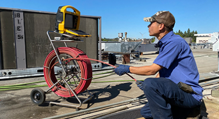
Utility Locating Equipment
Understanding the science behind accurate utility mapping is crucial for various industries and communities. By utilizing advanced technologies and methodologies, the accuracy of utility mapping can significantly impact infrastructure development, safety, and cost-efficiency. And, with Vivax-Metrotech’s utility locators, we at Haaker Underground can promise you’re getting the most accurate and adaptable set of tools on the market today. Message us or give us a call at (909) 598-2706 to better navigate your subterranean territory today.